Carl Brandan Mollweide
cartographerMaleb. 17740.0Global Dominance: 0.00%
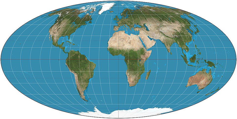
Carl Brandan Mollweide was a German mathematician and cartographer, best known for creating the Mollweide projection in 1805, which presents a more accurate representation of the Earth's surface compared to the traditional Mercator projection. His work has had a lasting impact on the field of cartography, and his projection is widely used in various applications to represent global data while minimizing distortion of area.
Power0
Reach0
Collect
Not in the pool (under ¢1).
Recent news mentions
Carl Brandan Mollweide created a more accurate map projection in 1805.
Wie manche Weltkarten die wahre Größe von Regionen verzerrenLuxemburger Wort· Luxembourg· 2025-10-27